2. 地图中显示标记
为实体和页面添加属性
我们为 User 实体添加 location 属性:
在 Jmix 工具窗口双击 User 实体,并选择其最后一个属性(为了将新属性添加至最后):
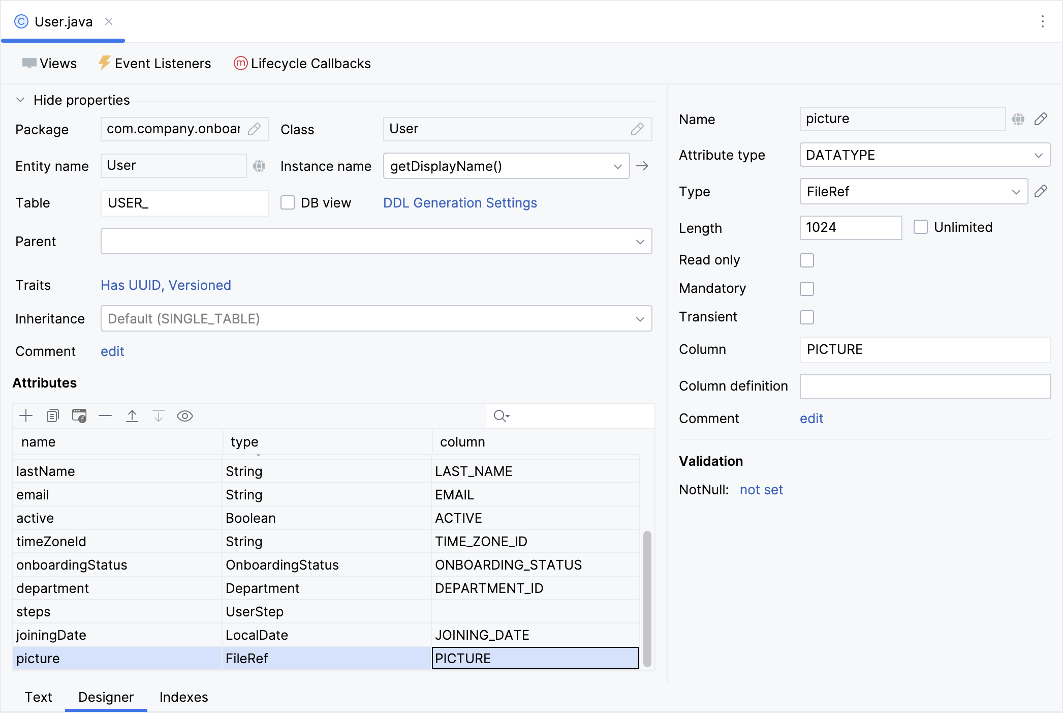
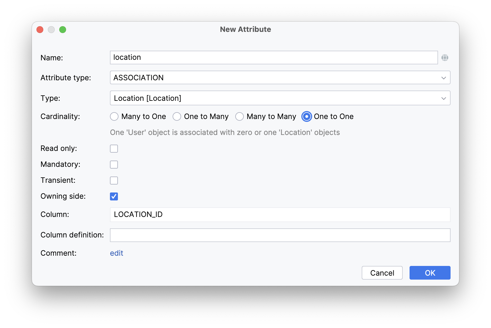
点击 Attributes 工具栏的 Add( )。在 New Attribute 对话框中,Name 输入
 location,Attribute type 选择 ASSOCIATION,Type 选择 Location。勾选 One to One 和 Owning Side 复选框。
为了建立一对一的 引用,Studio 会推荐在 Location 实体中生成一个反向属性。
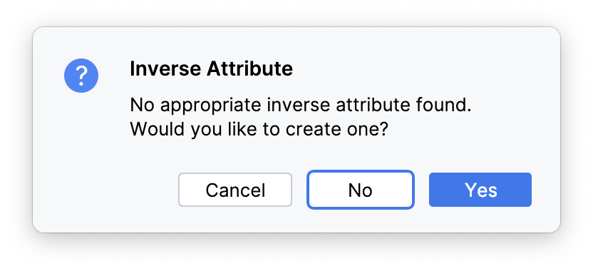
点击 Yes,然后下一个对话框中点击 OK。
选择 location 属性,点击 Attributes 工具栏的 Add to Views( ):
):
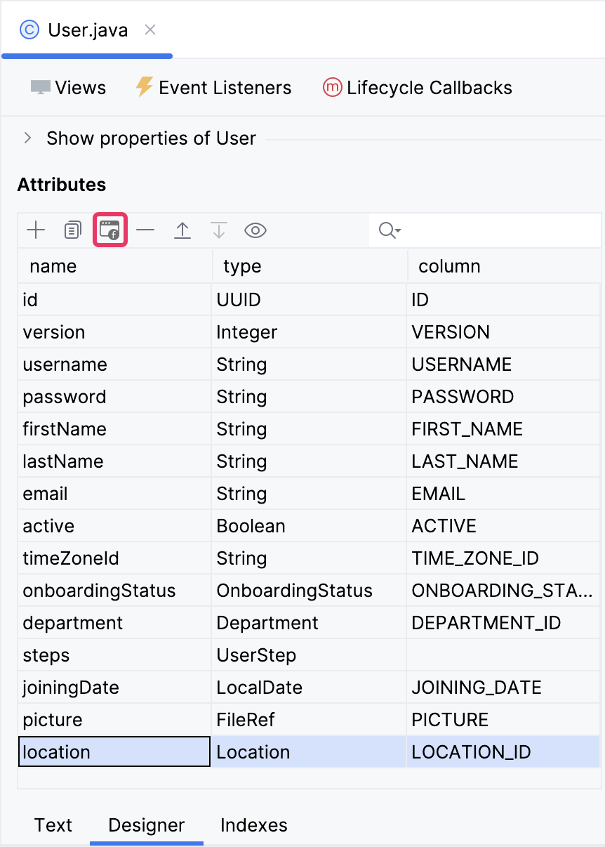
随后的对话框中显示所有能展示 User 实体的视图。我们选择 User.detail 视图:
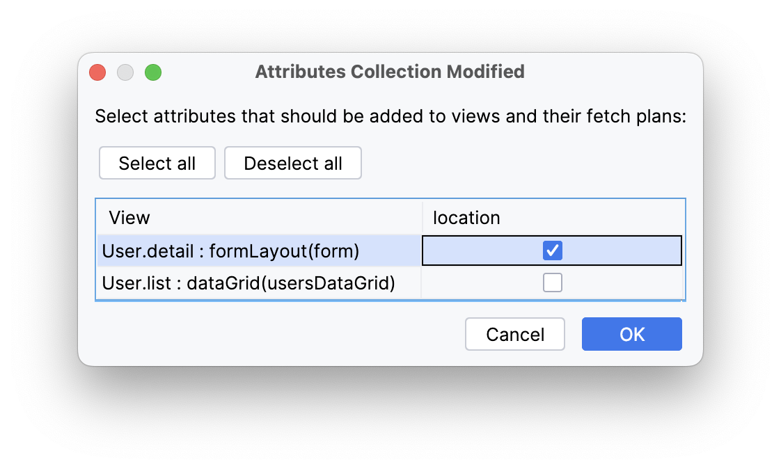
Studio 会自动在 User.detail 视图的 fetchPlan 中添加 location 属性,并在 formLayout 中增加一个 entityPicker 组件。
点击主工具栏的 Debug 按钮( )。
)。
应用程序启动前,Studio 会生成一个 Liquibase changelog:
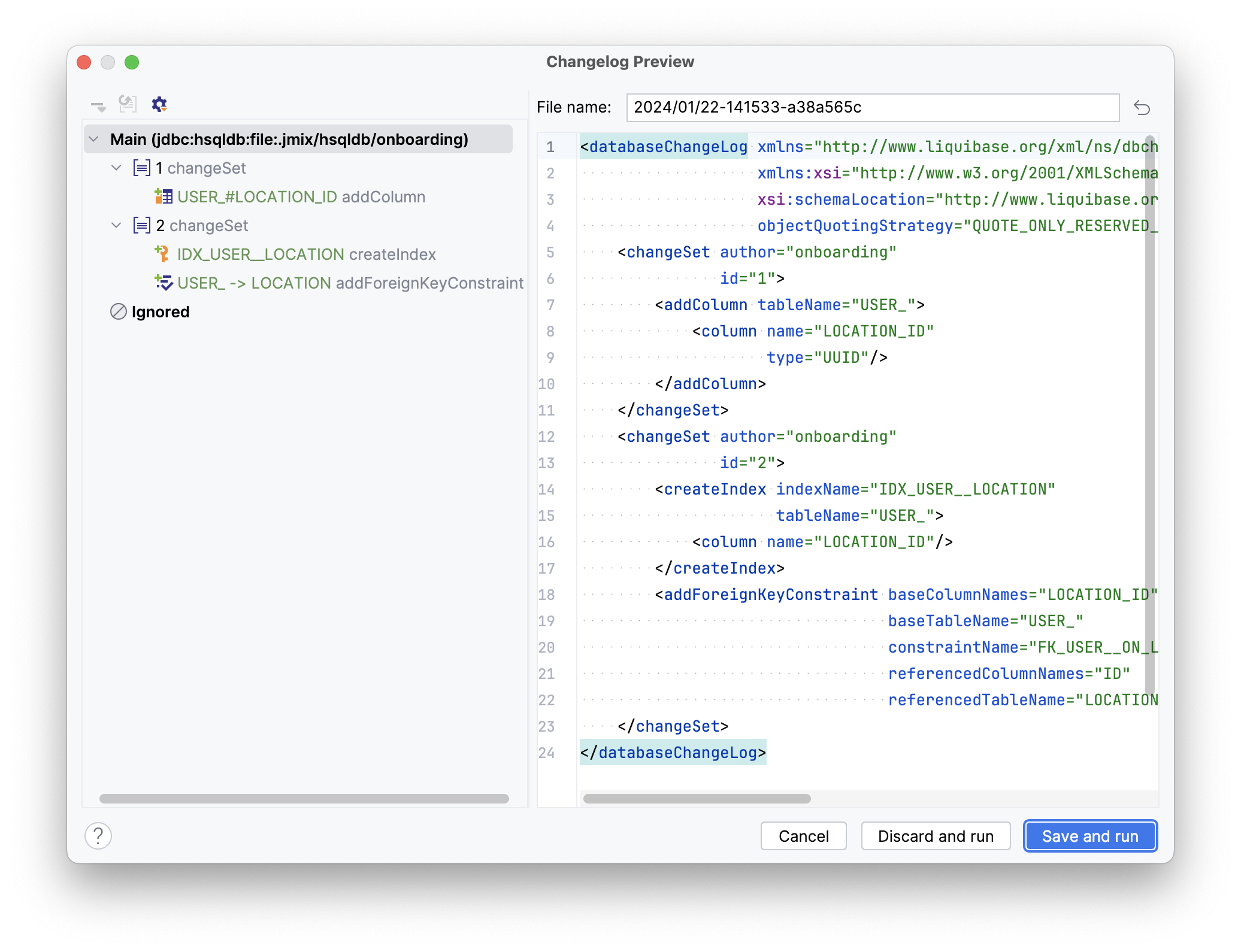
点击 Save and run。
Studio 会先在数据库运行 changelog,然后构建并启动应用程序。
应用程序启动完成后,可以在浏览器打开 http://localhost:8080 用凭证 admin/admin 登录。
从 Application 菜单选择 Users 打开用户列表视图。
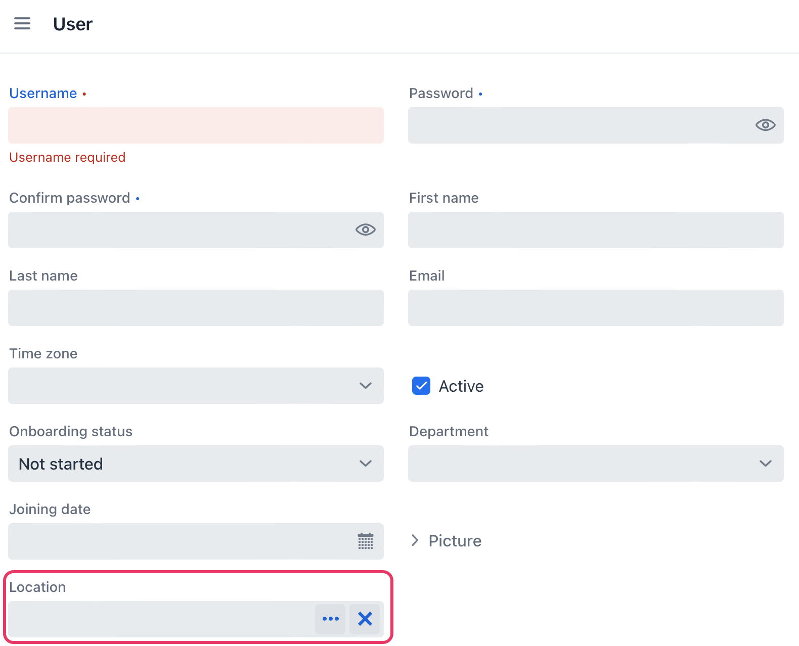
点击 Create。表单的底部会显示用于选择位置的控件:
创建空视图
如果你的应用程序还在运行,请点击主工具栏的 Stop 按钮( )。
)。
在 Jmix 工具窗口,选在 New()→ View:
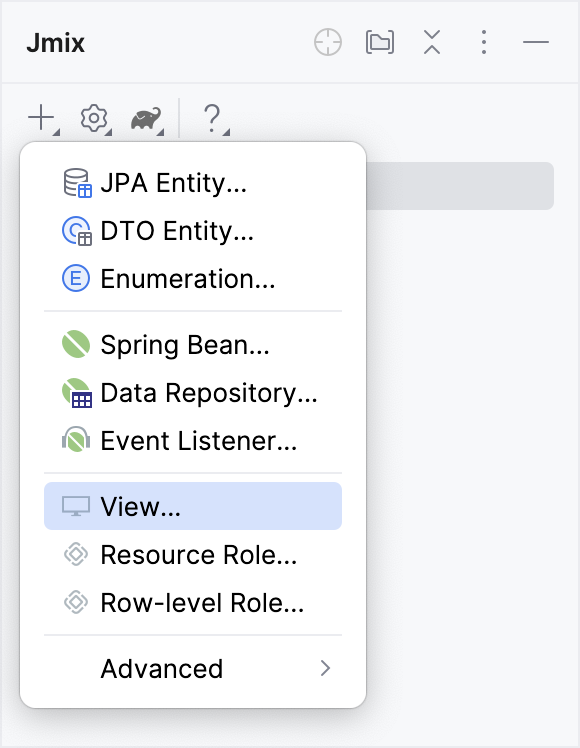
在 Create Jmix View 窗口,选择 Blank view 模板:
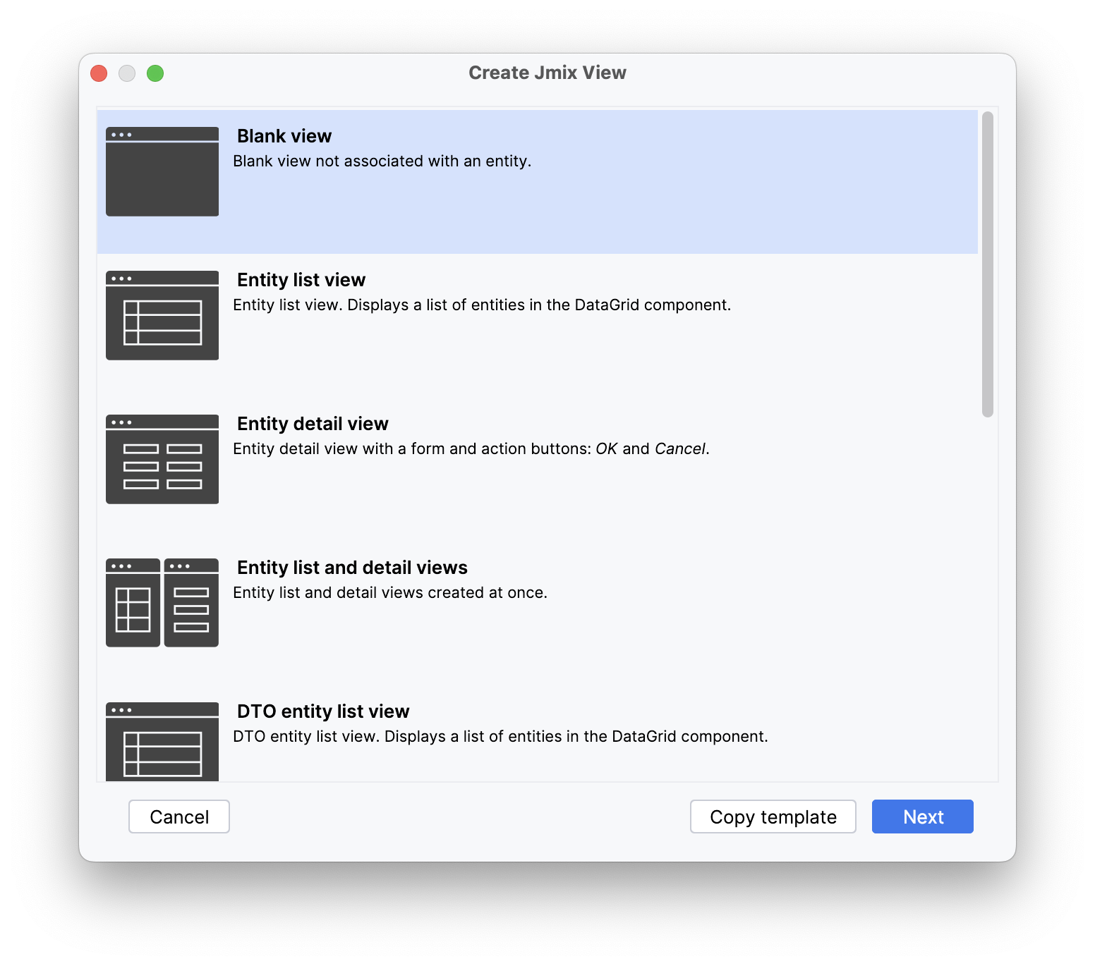
点击 Next。
向导的下一步中,输入以下内容:
-
Descriptor name:
location-lookup-view -
Controller name:
LocationLookupView -
Package name:
com.company.onboarding.view.locationlookup
删除 Parent menu item,这个视图不用这个设置。
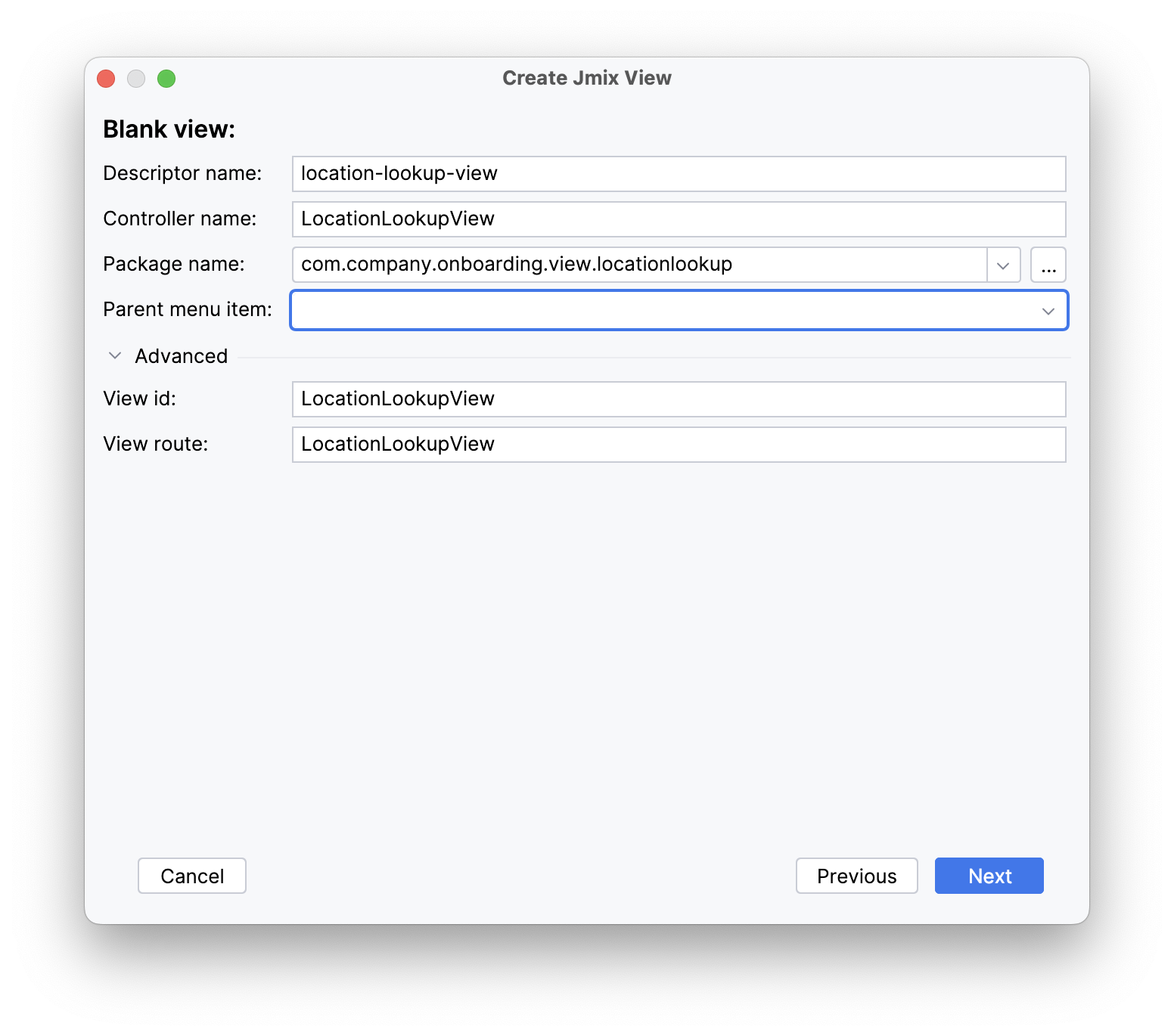
点击 Next,然后 Create。
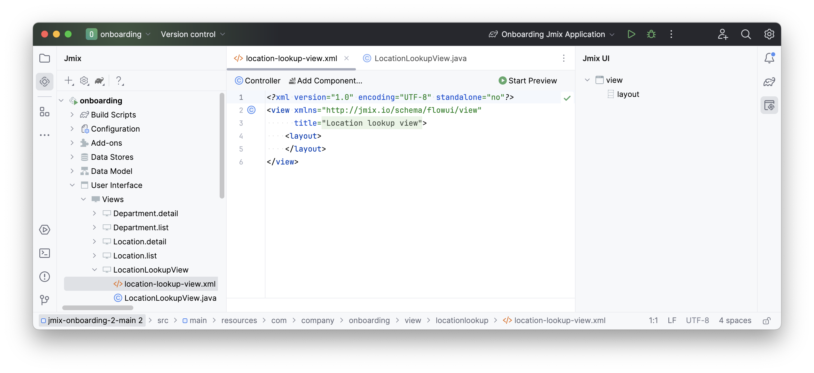
Studio 会生成一个空的视图,并在设计器显示:
打开新视图
我们的新视图是要从 user 的详情视图打开的,这里要用到 Location 字段。
需要将 Studio 生成的 entityPicker 组替换为 valuePicker 组件。打开 user-detail-view.xml 找到 formLayout 中的 entityPicker 组件:
<layout>
    <formLayout id="form" dataContainer="userDc">
        ...
        <entityPicker id="locationField" property="location">
            <actions>
                <action id="entityLookup" type="entity_lookup"/>
                <action id="entityClear" type="entity_clear"/>
            </actions>
        </entityPicker>
        ...
    </formLayout>
</layout>
修改组件的 XML 元素为 valuePicker,并删除其中的 actions 元素。
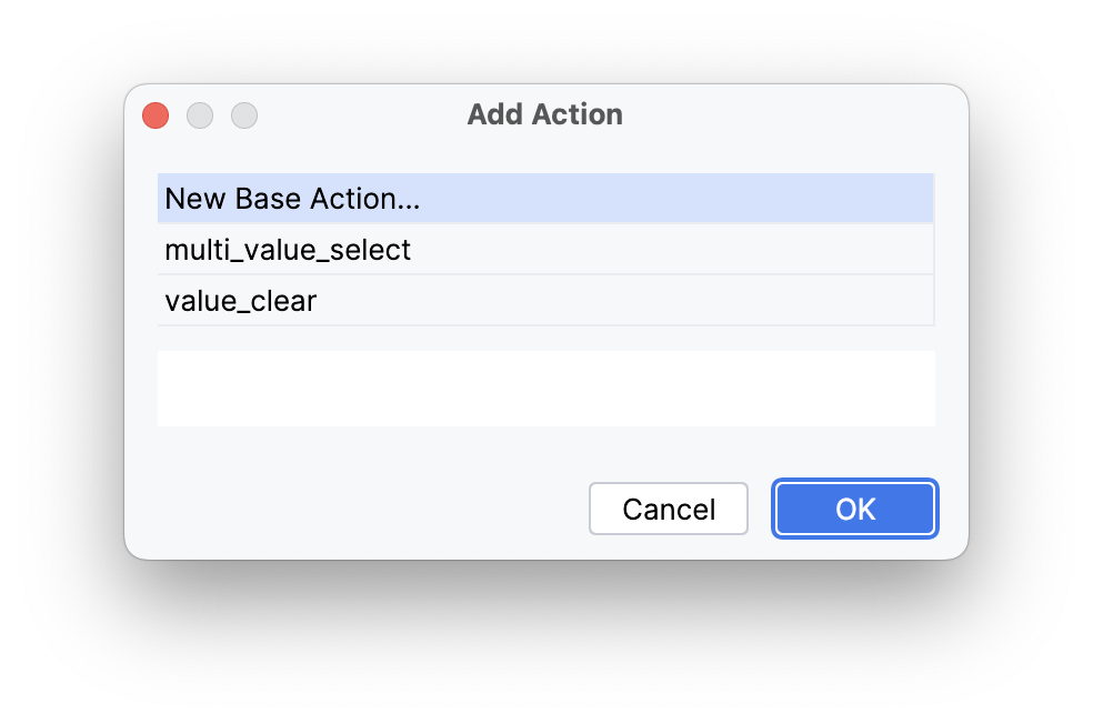
在 Jmix UI 结构面板或 XML 中选择 valuePicker,然后点击组件面板的 Add 按钮。在下拉列表中,选择 Actions → Action。
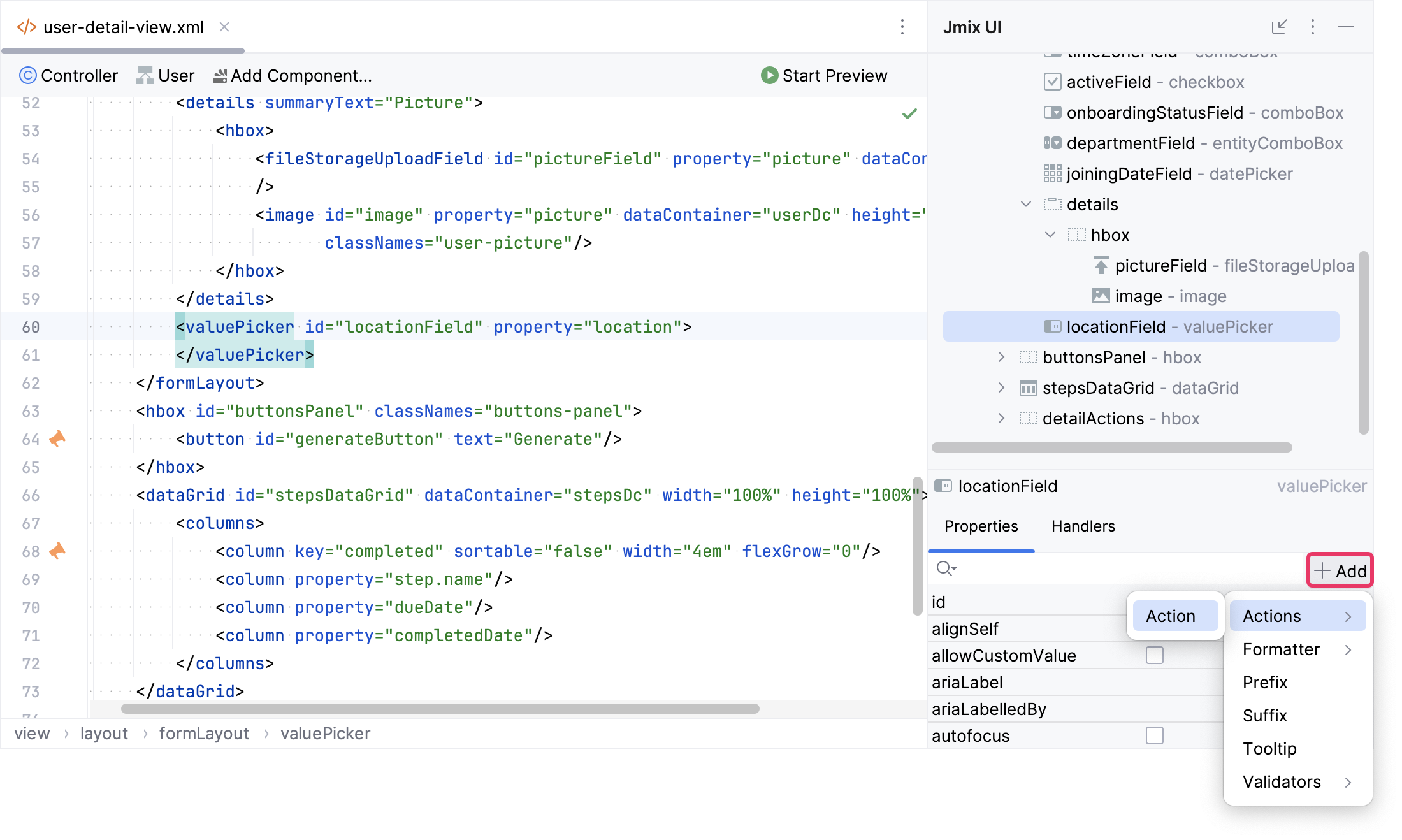
首先,选择一个 New Base Action 并点击 OK。
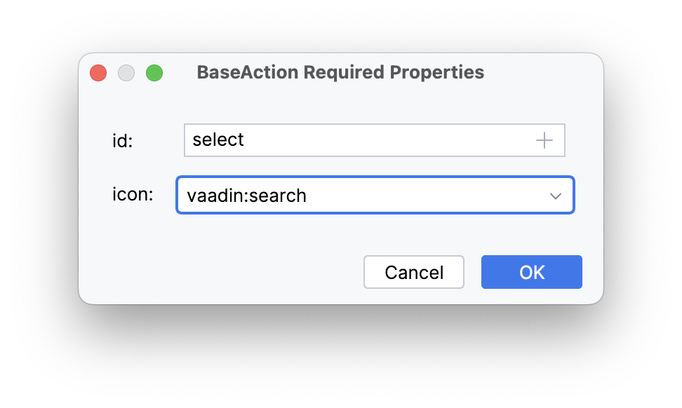
设置操作的 id 为 select, icon 为 vaadin:search。
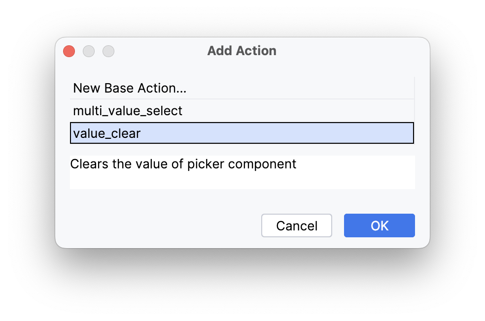
然后,为 locationField 添加一个内置的 value_clear 操作:
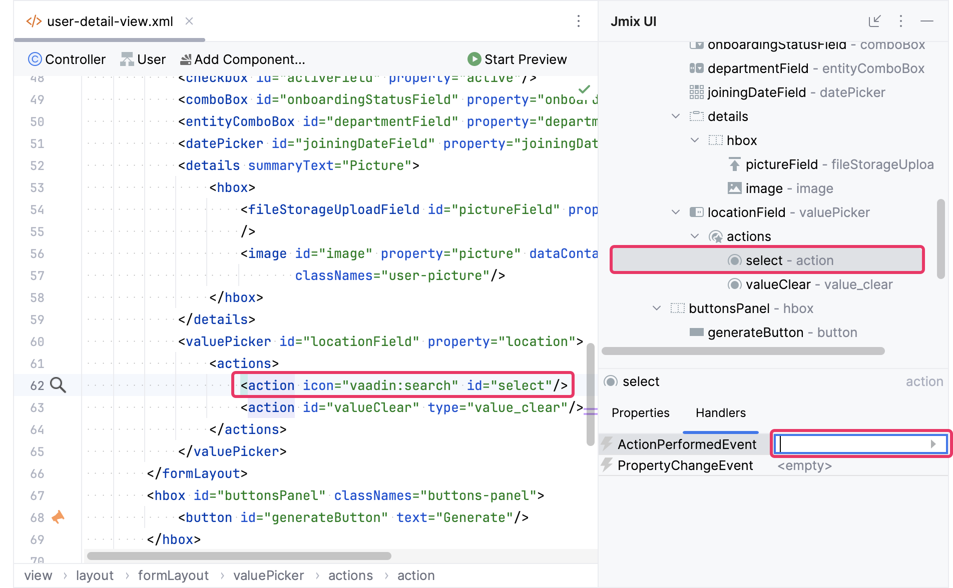
在 Jmix UI 结构面板或 XML 中选择 select 操作。然后在 Jmix Inspector 中切换至 Handlers tab,生成一个 ActionPerformedEvent 的处理方法:
在 ActionPerformedEvent 的处理方法中,添加打开 LocationLookupView 的逻辑:
@Autowired
private DialogWindows dialogWindows; (1)

@Subscribe("locationField.select")
public void onLocationFieldSelect(final ActionPerformedEvent event) {
    dialogWindows.view(this, LocationLookupView.class).open();
}| 1 | DialogWindows 提供以对话框的方式打开视图的流式接口。 |
启动应用程序,在 Application 菜单选择 Users。点击 Create 打开 User.detail 视图。找到 Location 字段,点击( )Search 按钮。该操作会打开
 LocationLookupView 对话框。
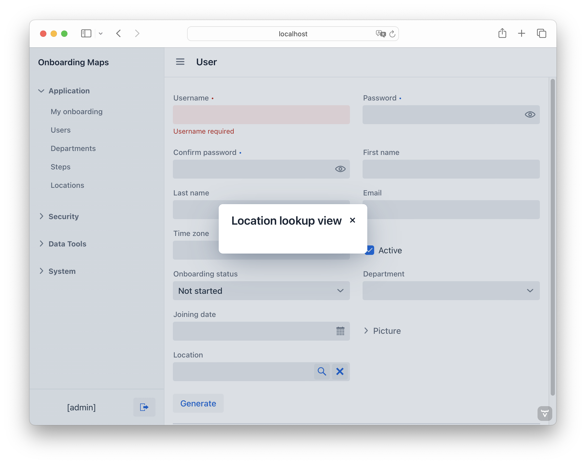
现在有时间可以回顾一下我们在视图中的改动。
为 LocationLookupView 添加组件
首先,添加一个控件用于展示当前地图中选择的位置。在操作面板中,点击 Add Component,找到 entityPicker,双击进行添加。配置该组件的属性如下:
<entityPicker id="currentLocationField"
              metaClass="Location"
              readOnly="true"
              width="20em"
              label="msg://currentLocationField.label"/>
下一步,我们将添加两个 hbox 容器:
-
第一个将包含一组位置以及一个地图。
-
第二个将包含 Select 和 Cancel 按钮。
<hbox padding="false"
      height="100%"
      width="100%"/>
<hbox id="controlLayout"/>
点击操作面板中的 Add Component,然后将 Layouts → VBox 拖放至 Jmix UI 结构面板中的第一个 hbox 元素。配置 vbox 如下:
<vbox padding="false" width="25em"/>接下来,添加一个用于选择位置类型的控件。点击操作面板中的 Add Component,找到 select,拖放至 vbox 内。配置组件的属性如下:
<select id="locationTypeField"
        emptySelectionAllowed="true"
        width="20em"
        itemsEnum="com.company.onboarding.entity.LocationType"/>
为了展示位置的列表,我们使用 listBox 组件。这里需要先引入一个数据容器,为列表组件提供 Location 实体集合。点击操作面板中的 Add Component,在 Data components 里双击 Collection。在 Collection Properties Editor 窗口中,Entity 字段选 Location,点击 OK:
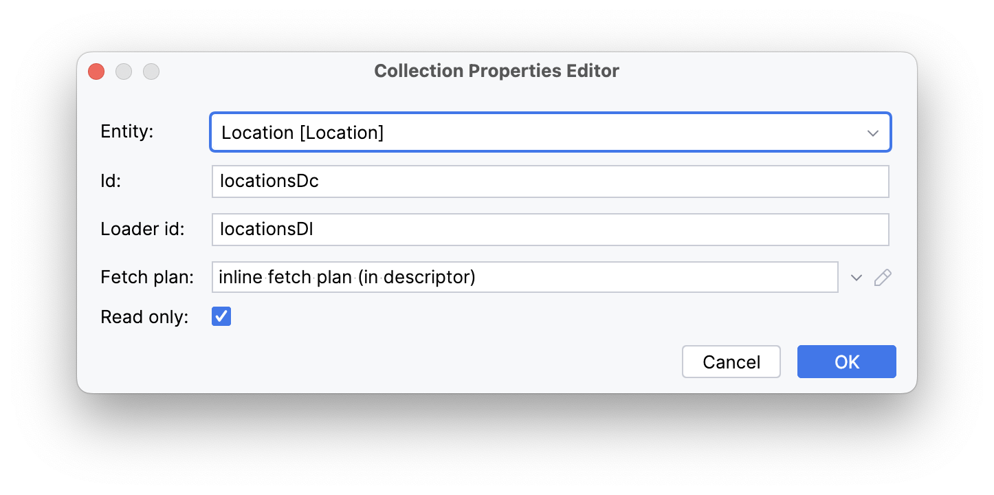
Studio 会生成集合数据容器:
<data>
    <collection id="locationsDc" class="com.company.onboarding.entity.Location">
        <fetchPlan   extends="_base"/>
        <loader id="locationsDl" readOnly="true">
            <query>
                <![CDATA[select e from Location e]]>
            </query>
        </loader>
    </collection>
</data>
加载数据
需要引入 dataLoadCoordinator facet 以触发刚创建的数据加载器。
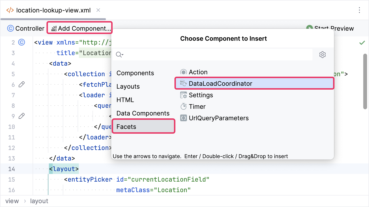
默认的查询语句会加载所有的 Location 实例,但是我们仅需要在 locationTypeField 组件中选中的那些类型的实例。因此,我们声明一个 查询条件,其中有一个输入参数,通过 DataLoadCoordinator 提供。
在查询条件中,我们用 component_ 前缀表示引用 locationTypeField 组件的值。
下面是在 XML 元素中声明 <condition> 的内容:
<view xmlns="http://jmix.io/schema/flowui/view"
      title="msg://locationLookupView.title"
      xmlns:c="http://jmix.io/schema/flowui/jpql-condition"> (1)
    <data>
        <collection id="locationsDc" class="com.company.onboarding.entity.Location">
            <fetchPlan extends="_base"/>
            <loader id="locationsDl" readOnly="true">
                <query>
                    <![CDATA[select e from Location e]]>
                    <condition> (2)
                        <c:jpql> (3)
                            <c:where>e.type = :component_locationTypeField</c:where> (4)
                        </c:jpql>
                    </condition>
                </query>
            </loader>
        </collection>
</data>| 1 | 添加 JPQL 条件命名空间。 |
| 2 | 在 query` 中定义 condition 元素。 |
| 3 | 定义一个 JPQL 条件,其中可以包含可选的 join 元素和必需的 where 元素。 |
| 4 | WHERE 子句中对 type 属性使用 :component_locationTypeField 参数进行过滤。 |
添加 ListBox
点击操作面板中的 Add Component,找到 listBox,拖放至 vbox 内,配置组件的属性如下:
<listBox id="listBox"
         itemsContainer="locationsDc"
         minHeight="20em"
         width="20em"/>
此时,视图的 XML 是这样的:
<?xml version="1.0" encoding="UTF-8" standalone="no"?>
<view xmlns="http://jmix.io/schema/flowui/view"
      title="msg://locationLookupView.title"
      xmlns:c="http://jmix.io/schema/flowui/jpql-condition">
    <data>
        <collection id="locationsDc" class="com.company.onboarding.entity.Location">
            <fetchPlan extends="_base"/>
            <loader id="locationsDl" readOnly="true">
                <query>
                    <![CDATA[select e from Location e]]>
                    <condition>
                        <c:jpql>
                            <c:where>e.type = :component_locationTypeField</c:where>
                        </c:jpql>
                    </condition>
                </query>
            </loader>
        </collection>
    </data>
    <facets>
        <dataLoadCoordinator auto="true"/>
    </facets>
    <layout>
        <entityPicker id="currentLocationField"
                      metaClass="Location"
                      readOnly="true"
                      width="20em"
                      label="msg://currentLocationField.label"/>
        <hbox padding="false"
              height="100%"
              width="100%">
            <vbox padding="false"
                  width="25em">
                <select id="locationTypeField"
                        emptySelectionAllowed="true"
                        width="20em"
                        itemsEnum="com.company.onboarding.entity.LocationType">
                </select>
                <listBox id="listBox"
                         itemsContainer="locationsDc"
                         minHeight="20em"
                         width="20em"/>
            </vbox>
        </hbox>
        <hbox id="controlLayout"/>
    </layout>
</view>
可以运行应用程序并查看新加的功能。
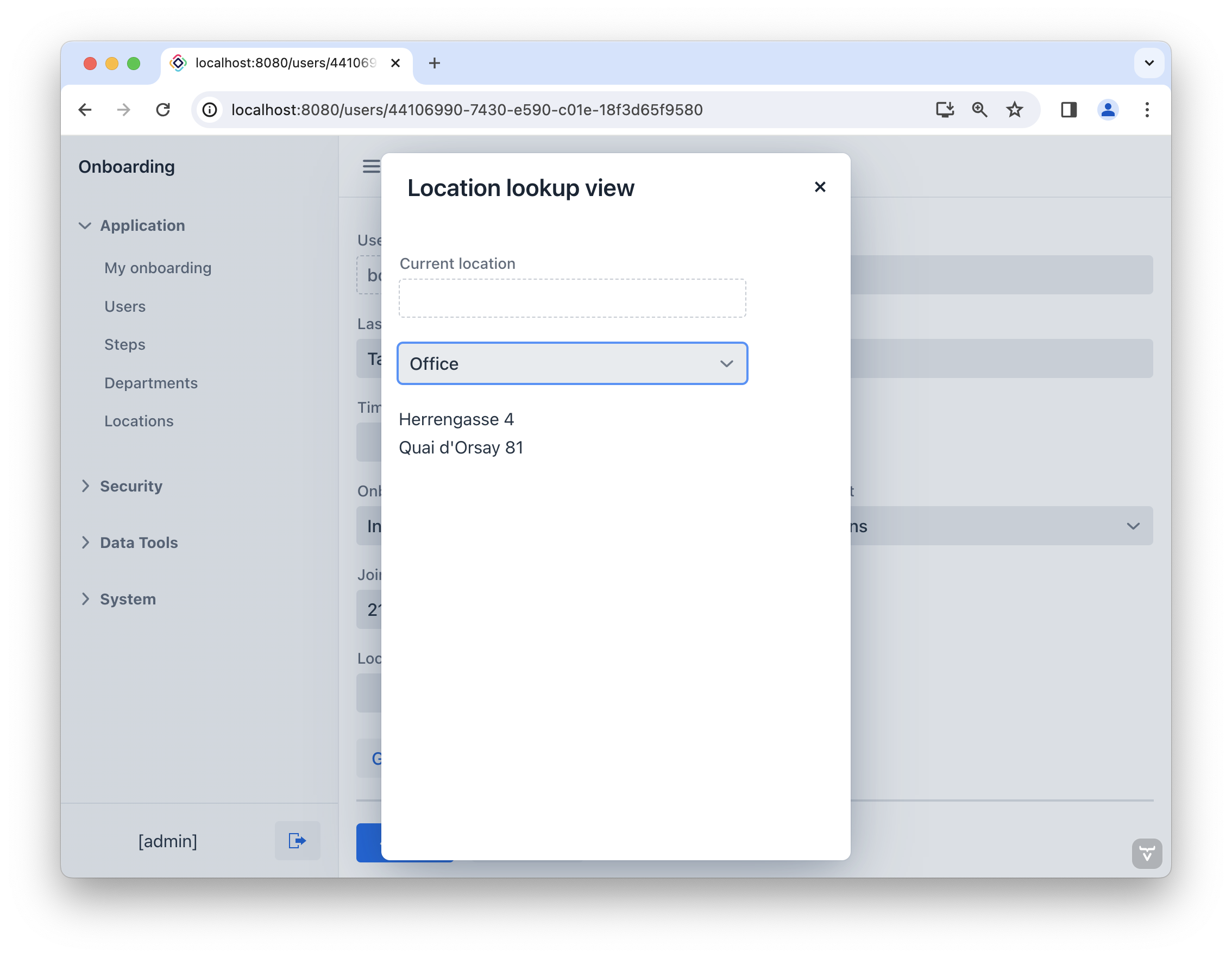
添加地图
将光标移至 vbox 元素的后面。点击操作面板中的 Add Component,找到 GeoMap 并双击进行添加。
此时,Jmix UI 结构和 XML 中都会在 vbox 元素的下方添加新的 geoMap 元素。按照下面的代码配置 id、height 和 width 属性。
<maps:geoMap id="map"
             height="100%"
             width="100%"/>
接下来,为地图引入一个 OsmSource 的瓦片层,设置一个 map view,然后添加一个 DataVectorSource 的矢量层。完整的地图配置如下:
<maps:geoMap id="map"
             height="100%"
             width="100%">
    <maps:mapView centerX="0" centerY="51">
        <maps:extent minX="-15" minY="30" maxX="40" maxY="60"/>
    </maps:mapView>
    <maps:layers>
        <maps:tile>
            <maps:osmSource/>
        </maps:tile>
        <maps:vector id="dataVectorLayer">
            <maps:dataVectorSource id="buildingSource"
                                   dataContainer="locationsDc"
                                   property="building"/>
        </maps:vector>
    </maps:layers>
</maps:geoMap>
启动应用程序查看新添加的功能。
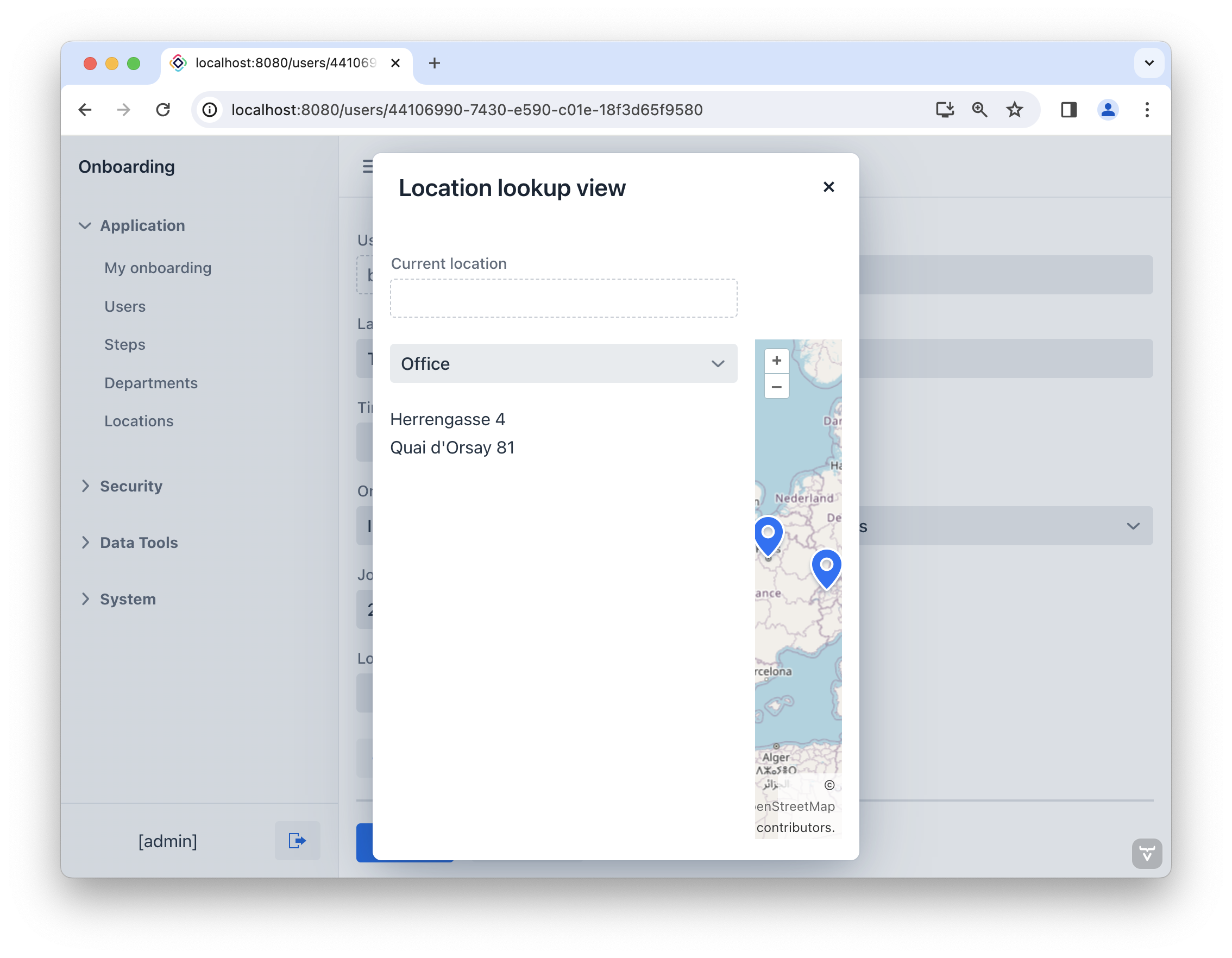
可以看到,地图并不能适配视图。因此,我们需要修改视图的大小。为 LocationLookupView 视图控制器添加 @DialogMode 注解:
@Route(value = "LocationLookupView", layout = MainView.class)
@ViewController("LocationLookupView")
@ViewDescriptor("location-lookup-view.xml")
@DialogMode(width = "60em", height = "45em")
public class LocationLookupView extends StandardView {
}
按下 Ctrl/Cmd+S 保存更改并切换至运行中的程序。点击 Location 控件的 Search 按钮()。此时打开的 LocationLookupView 视图大小就是我们刚配置的大小。
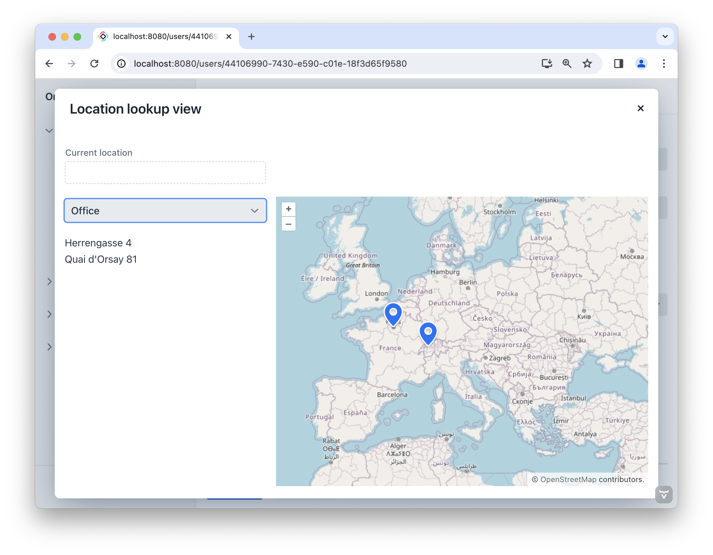
使用自定义标记 部分将介绍如何为 offices 和 coworking 使用不同的标记。
添加按钮
下面我们添加两个按钮:Select 按钮用于保存当前的位置信息,Cancel 按钮可以直接取消不保存。
打开 location-lookup-view.xml 找到 controlLayout hbox。点击操作面板中的 Add Component,并在 controlLayout 中添加两个按钮。
新创建的按钮需要关联操作。按照下面的代码定义 actions 以及内部的 action 元素:
<actions>
    <action id="select"
            text="msg://selectAction.text"
            icon="CHECK"
            actionVariant="PRIMARY"
            enabled="false"/> (1)
    <action id="cancel"
            type="view_close"/> (2)
</actions>通过 Jmix UI inspector panel → Handlers tab 生成操作的处理方法:
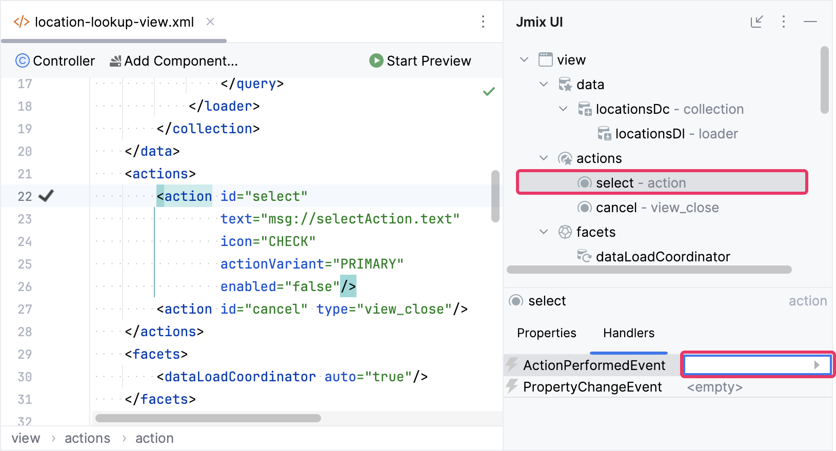
实现 select 操作处理方法:
@Subscribe("select")
public void onSelect(final ActionPerformedEvent event) {
    close(StandardOutcome.SELECT); (1)
}| 1 | close() 能关闭当前视图。StandardOutcome.SELECT 参数可以由调用端代码进行处理。我们 在后面 进行处理。 |
按照下面的代码配置按钮的 ID 以及操作:
<hbox id="controlLayout">
    <button id="selectBtn" action="select"/>
    <button id="cancelBtn" action="cancel"/>
</hbox>
使用自定义标记
切换至 Project 工具窗口,在 /src/main/resources/META-INF/resources/icons/ 目录可以看到为 offices 和 coworking 准备的不同图标:
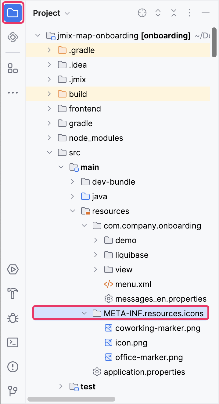
打开 LocationLookupView 控制器,并注入 buildingSource。
@ViewComponent("map.dataVectorLayer.buildingSource")
private DataVectorSource<Location> buildingSource;|
操作面板的 Inject 按钮可以用来注入视图组件或 Spring bean: 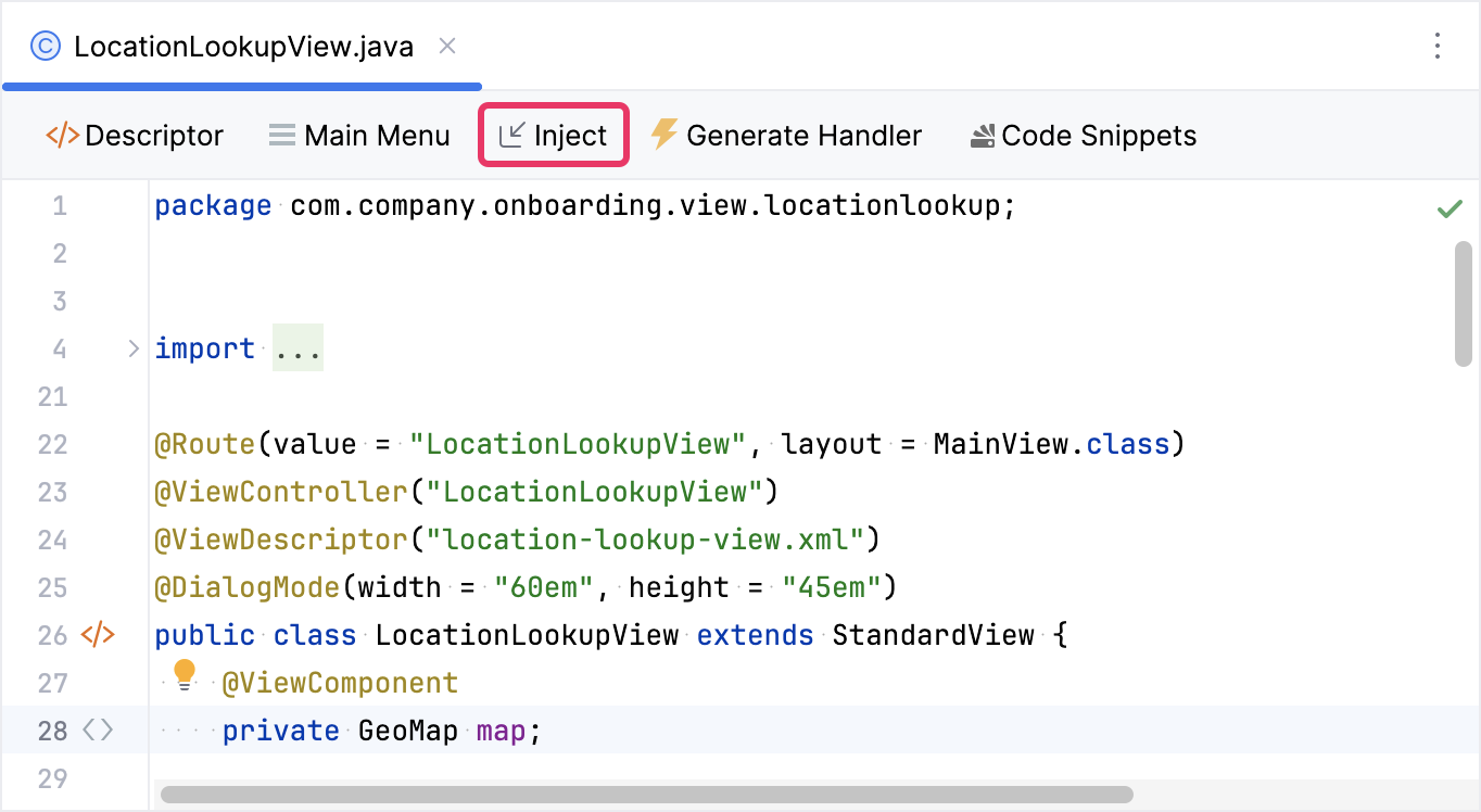
|
下一步,引入一个方法自定义标记:
private void initBuildingSource(){
    buildingSource.setStyleProvider(location -> new Style() (1)
            .withImage(new IconStyle()
                    .withScale(0.5)
                    .withAnchorOrigin(IconOrigin.BOTTOM_LEFT)
                    .withAnchor(new Anchor(0.49, 0.12))
                    .withSrc(location.getType() == LocationType.OFFICE
                            ? "icons/office-marker.png"
                            : "icons/coworking-marker.png"))
            .withText(new TextStyle()
                    .withBackgroundFill(new Fill("rgba(255, 255, 255, 0.6)"))
                    .withPadding(new Padding(5, 5, 5, 5))
                    .withOffsetY(15)
                    .withFont("bold 15px sans-serif")
                    .withText(location.getCity())));
}| 1 | 建立新样式,将图像与文本标签相结合组成标记。图像根据位置类型选择。 |
点击顶部操作面板的 Generate Handler 按钮并选择 Controller handlers → InitEvent:
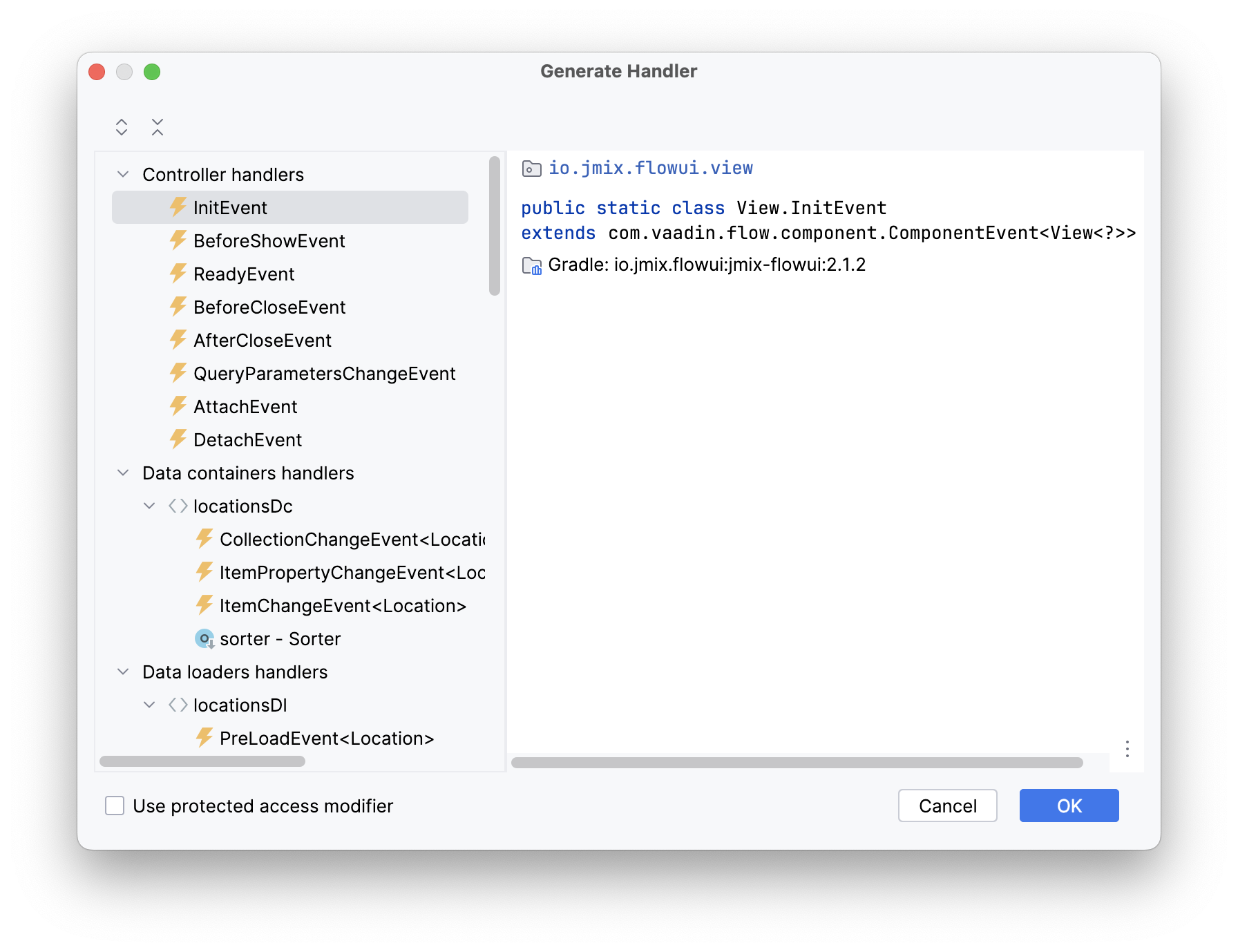
点击 OK。Studio 会自动生成一个方法的桩代码。我们在里面调用 initBuildingSource():
@Subscribe
public void onInit(final InitEvent event) {
    initBuildingSource();
}
启动应用程序并打开 LocationLookupView。可以看到不同类型位置的标记也不同。
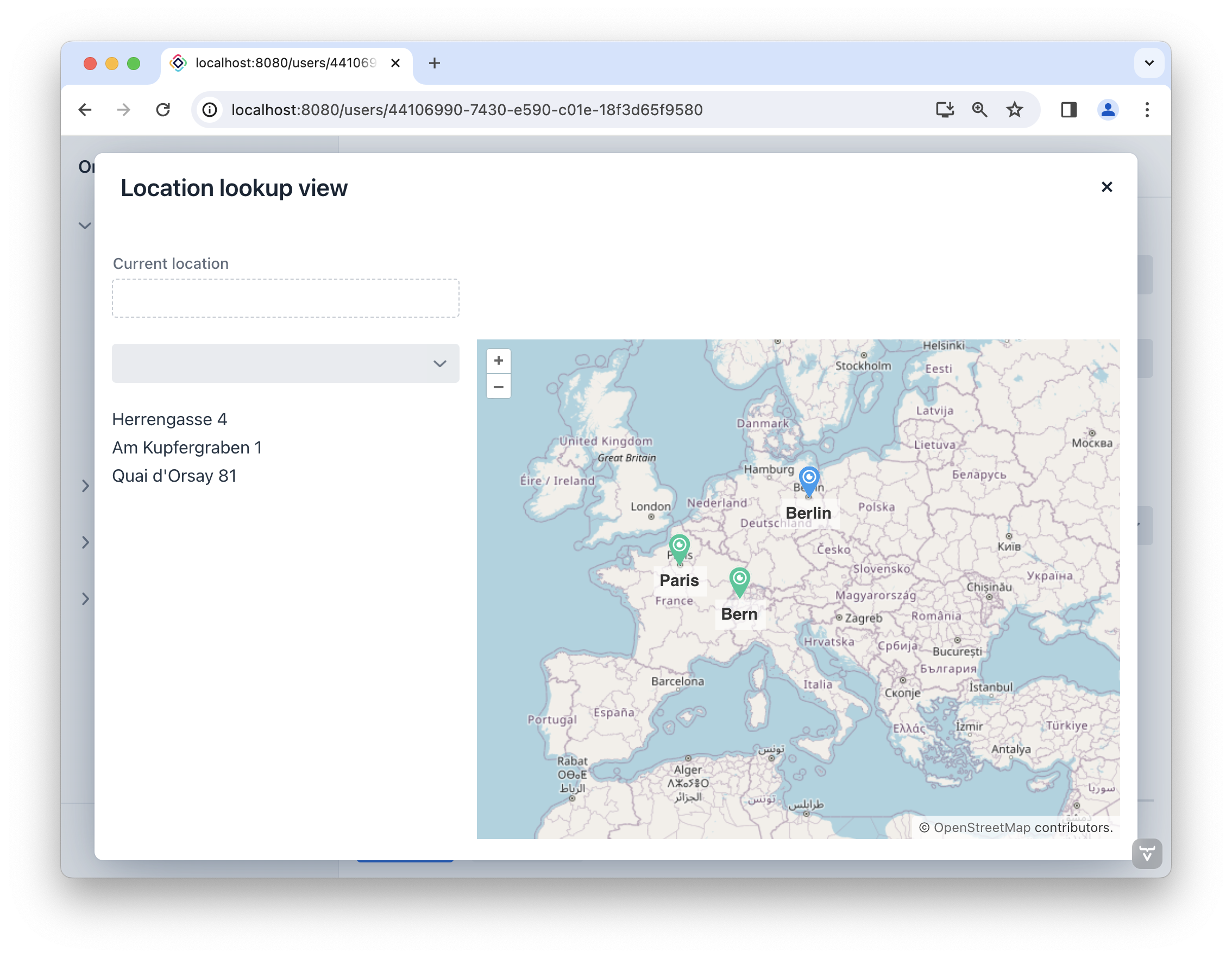
处理标记事件
一旦用户在地图中选择了一个标记,则标记的位置将填入 Current location 字段。还有,地图将以选择的位置为中心并调整缩放级别。
打开 LocationLookupView 控制器,并添加 setMapCenter() 方法:
private void setMapCenter(Geometry center) {
    map.fit(new FitOptions(center)
            .withDuration(2000)
            .withEasing(Easing.LINEAR)
            .withMaxZoom(20d));
}
找到 initBuildingSource() 方法,并在最后添加如下代码:
private void initBuildingSource(){
    //...
    buildingSource.addGeoObjectClickListener(clickEvent -> {
        Location location = clickEvent.getItem();

        setMapCenter(location.getBuilding());
    });
}
运行应用程序查看最新改动。现在点击标记时,地图会以标记的坐标为中心,并进行放大。
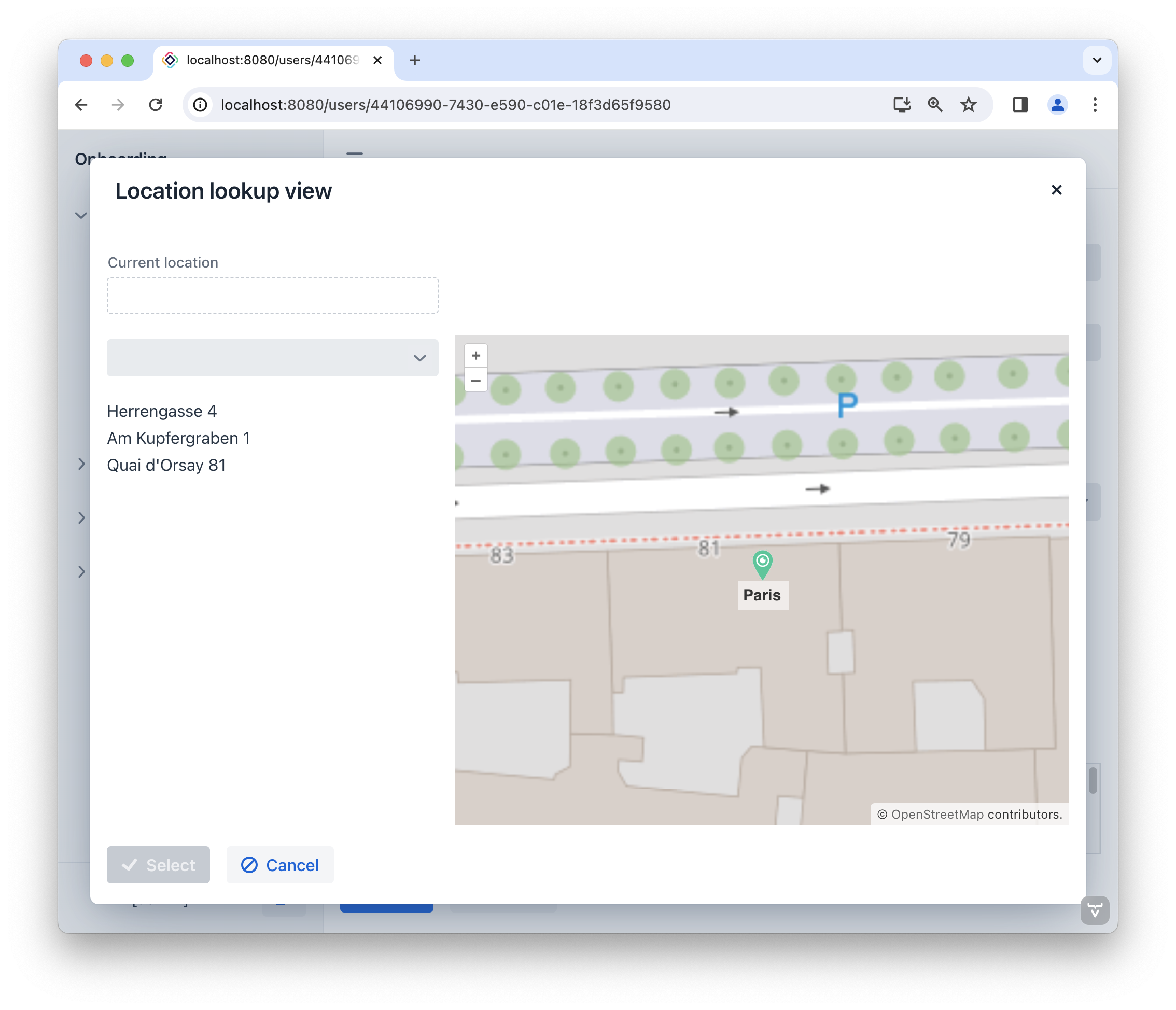
现在我们要在 Current location 控件显示选择的位置,并启用 Select 按钮。
在 LocationLookupView 控制器中,注入 currentLocationField 组件以及 select 操作。定义 selected 变量:
@ViewComponent
private EntityPicker<Location> currentLocationField;

@ViewComponent
private BaseAction select;

private Location selected;
然后添加 onLocationChanged() 方法:
private void onLocationChanged(Location newLocation) {
    if (newLocation != null)
        if (!Objects.equals(newLocation, selected)) {
            selected = newLocation;
            select.setEnabled(true); (1)

            setMapCenter(newLocation.getBuilding());

            currentLocationField.setValue(newLocation); (2)
        }
}| 1 | 启用 Select 操作。 |
| 2 | 将选择的位置填入 Current location 控件。 |
在 initBuildingSource() 中调用 onLocationChanged():
private void initBuildingSource(){
    //...
    buildingSource.addGeoObjectClickListener(clickEvent -> {
        //...
        onLocationChanged(location);
    });
}